Heritage
Historical Structures Restored
The following structures were restored during the SeaScapes project:
- Red Acre steps at Seaham Marina in 2022 and opened in 2023.
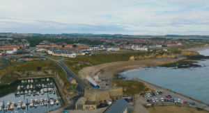
- The Hartlepool High Light in 2023 – ready for the Tall Ships Race in July 2023.
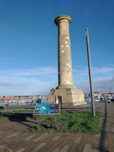
- The Wave Basin Battery in July 2024
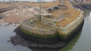
The Wave Basin Battery in Sunderland docks – the interpretation sign is located opposite the battery as the battery is part of Sunderland docks and is not publicly accessible.
These allowed these historical sites to remain intact, and to be enjoyed by the local community and visitors alike.
Archaeological Digs
Tees Archaeology has been working on various heritage projects as part of SeaScapes.
- Roker Battery in 2022
- Whitburn in 2023
- Heugh Lighthouse site in July 2024
- Seaton Carew dig August 2024
The dig reports can be found the Resources webpage under Tees Archaeology.
Buildings Survey at Seaton Carew
In May 2024, Tees Archaeology also trained volunteers to survey buildings in Seaton Carew as part of the historic buildings survey in Seaton Carew conservation area.
The Buildings Survey report can be found in the Resources webpage under Tees Archaeology.
Sound Mirror
The story of the Sound Mirrors – constructed during World War I to enable the Zeppelins to be heard before they arrived and to prepare the coastal gun batteries to be ready for their arrival. The best remaining Sound Mirror is located at Fulwell, Sunderland – photograph below.
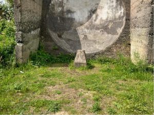
The bombing of Hartlepool was used as a story background and the damage done to houses on the Headland at Hartlepool was researched and used as a narrative to accompany sound projects – see the Sound Mirror website: https://www.soundmirror.xyz/about/index.html. The sound artist also collected sounds during the project and re-interpreted them as part of the wider sound project.
Food History
The FoodScapes project looks at different food types and their history in the region. For each of the 8 maps, there are 10 points located on each map. The first point describes the history and the last point talks about the future of that food type. The remaining 8 points give history about that food category in a particular location. The different food categories include drinks, salt, fish amongst others. The 8 maps are accessed via Google Earth and shows the location of the category item, see the Resources page for how to access the Food Atlas.
Coastal App locations
The SeaScapes Coastal app (downloadable Free from your favourite app store) shows the locations of interpretations signs along the coast. These contain historic, cultural or wildlife stories along the coast often with historical photographs sourced from various regional archives.
Wrecks along the Coast
The Beneath the Wave team have been working with volunteer divers to record some of the wrecks off the Tyne to Tees coast. The team has developed a PADI Photogrammetry Course and taught local divers how to record and help build the 3D models and imagery required to fully appreciate the wrecks surveyed. In addition, to the Wrecks app the work also appeared in the SeaScapes Coastal app and some 3D models were printed and are on view at various locations.


