The SeaScapes project used many different ways to engage with people, from digital forms, to public events to volunteering in heritage and beach clean activities. Here is just a snapshot of what happened.
SeaScapes Coastal App – free to download from your favourite app store
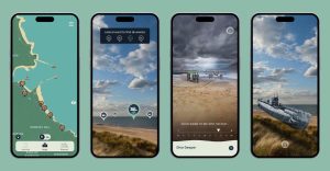
The app enables to you to learn more about the Tyne to Tees coast and discover our maritime heritage hidden beneath the waves.
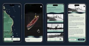
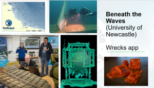
Wrecks app – this was created as a training tool for volunteer divers.
Google Earth Based – FoodScapes from Newcastle University, see the FoodScapes User Guide on the Resources page on how to access this resource.
ReadingtheRocks.com – created by Durham University – this is a website dedicated to celebrating our internally important Permian Magnesium Limestone coastline with coastal geology walks, videos, online resources and maps.
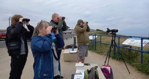
We also held: coastal walks and talks on wildflowers, birds, invertebrates, geology and heritage; cetacean and reptile surveys and rocky shore monitoring; beach cleans, beach activities for pre schoolers to teenagers; and created volunteering opportunities as beach clean leaders, SeaWatch observers, field name surveyors, Little Tern wardens, rangers and divers.
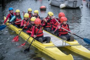
The BlueScapes project, hosted by the National Trust, worked on, in or near water and conducted a wide range of activities for their mental and physical health benefits. The project worked with those who may not have generally used the coast
We represented the scheme at major events such as the Tall Ships Race in Hartlepool in 2023.
And at the highly innovative Science and Arts symposium in November 2023 where international, national and regional artists showed how they were interpreting the coast and marine environment to their audiences.
Newcastle University PhD students worked with volunteer divers to start to document the wrecks off the Tyne to Tees coast. With over 600 wrecks off the SeaScapes coast there is still lots to do. The volunteer divers were taught how to video and use photogrammetry techniques to stitch the video taken into 3D models which could then be displayed or turned into a printed 3D model. The wrecks app was created as a tool for the divers to understand the process and how to identify items on the sea floor.
Interactions with schools and in particular primary schools to help the children learn about their coast. There were school visits to archaeological digs, museums and more creative projects such as the refurbishment of a coastal seat at Crimdon.
We worked often alongside volunteers to improve access to the coast. We created a Brus to Headland cycle route and a coast to Clavering Walk in Hartlepool; created short walks to the England Coast Path in County Durham; and repaired Red Acre Steps at Seaham Marina.
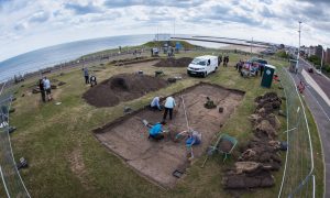
We had an extensive ‘Coast at War’ project working with Tees Archaeology and many volunteers. This carried out excavations and recorded buildings. The reports are in the Resources section of this website.
Roker Gun Battery Excavation
Springwell Sound Mirror, Hartlepool
Whitburn excavation

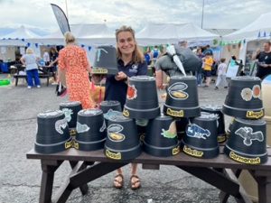
During the project we have developed 8 games. Look out for them if you join in activities with our partners!
SeaScapes has been an opportunity to enable research into our coastal heritage. We funded two PhDs at Newcastle University on the biodiversity of wrecks and carbon sequestration around wreck sites. The theses will be complete by 2026.
The Food Atlas researched local stories and food and drink products, and the SeaScapes Coastal App brought together historic stories and photographs researched from local photographic and history groups.
![]() Except where noted and excluding company and organisation logos, this work is shared under a Creative Commons Attribution Non-Commercial 4.0 (CC BY-NC 4.0) Licence.
Except where noted and excluding company and organisation logos, this work is shared under a Creative Commons Attribution Non-Commercial 4.0 (CC BY-NC 4.0) Licence.
Please attribute as: “Explore SeaScapes https://exploreseascapes.co.uk (2026) by Durham County Council funded by The National Lottery Heritage Fund, licensed under CC BY-NC 4.0″.
© 2026 SeaScapes. All rights reserved.