** We are currently undergoing scheduled maintenance to update some of our links and information. We will have everything ready soon. Sorry for any inconvenience and come back soon**
The SeaScapes project started in March 2020 and ended activities at the end of September 2024, with final project closedown in December 2024.
The structure and partners are explained in the About Us page as well as the list of all 23 sub-project involved in SeaScapes.
Below is a video of the amazing Tyne to Tees coastline which was the SeaScapes area. Just click the video to view it.
The focus of this website is on the benefits and outcomes that the SeaScapes project generated during those 4 years of activities.
The main topics can be found on the menu in the top right-hand corner. These topics are:
Each of these topics covers several projects and is focussed on how the SeaScapes partners delivered these aspects.
The resources page is a repository for many of the reports and documents created during the project. This includes video, photos, PDF reports and 3D models.
Below are some of our key digital outputs and how you can find them.
In addition to the content in this website, there are digital assets which are located in other locations:
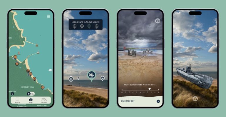
Download the free SeaScapes Coastal App from your favourite apps store and learn more about the Tyne to Tees Coast. Once the app is loaded on your phone, the app will ping the phone at key locations along the coast. At each location, the initial screen will tell you about the place and its point of interest, from which you can do a deeper dive into the information. Locations of wrecks off the coast will also enable you to find out more about the hidden heritage beneath the waves.
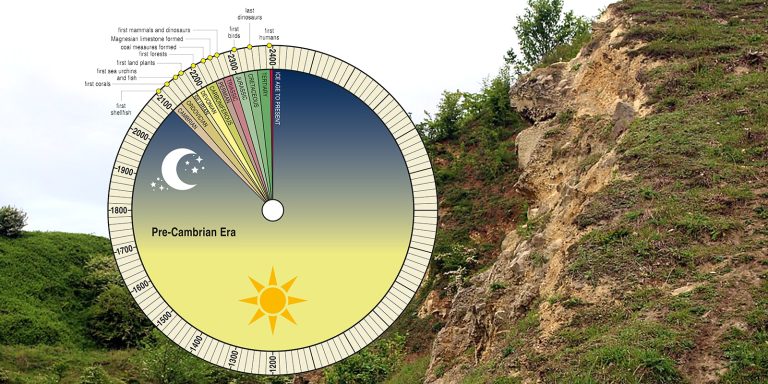
Our Reading the Rocks website takes you on self-guided geology walks along three Durham coast beaches. Through video, maps and photos you can learn about the geology before you head to the beach and then can find the geological features on the beaches.
This uses Google Earth as a platform to display a location-based food story relevant to that place.
Stories focusing on fishing, drink and salt combine with historic images and newly created text providing an interesting insight into the food-related history along out wider coast. Below you can see the user guide:
![]() Except where noted and excluding company and organisation logos, this work is shared under a Creative Commons Attribution Non-Commercial 4.0 (CC BY-NC 4.0) Licence.
Except where noted and excluding company and organisation logos, this work is shared under a Creative Commons Attribution Non-Commercial 4.0 (CC BY-NC 4.0) Licence.
Please attribute as: “Explore SeaScapes https://exploreseascapes.co.uk (2026) by Durham County Council funded by The National Lottery Heritage Fund, licensed under CC BY-NC 4.0″.
© 2026 SeaScapes. All rights reserved.